Report presents economic, environmental strategies for Chicago’s Calumet River area
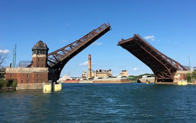
A new report developed by University of Illinois at Chicago researchers offers strategies to address environmental and economic issues in communities located along the Calumet River on Chicago’s Southeast Side.
Produced by the Great Cities Institute at UIC, the report provides a framework for the region to plan and carry out future projects that deal with public health and the environment, social equity, and economic development. Additional features of the report include neighborhood demographic profiles, land use and zoning maps, and housing data.
“We hope this document will serve as a resource guide for the communities and allow community organizations, elected officials, city agencies, and other contributors to the built and social environment of Southeast Chicago to better coordinate efforts and share resources to improve the quality of life for all residents,” the researchers state.
The study area, which includes portions of South Chicago, the East Side, and South Deering community areas, is bounded by 83rd Street to the north, 106th Street to the south, Lake Michigan and the Indiana border to the east, and Yates Boulevard to the west.
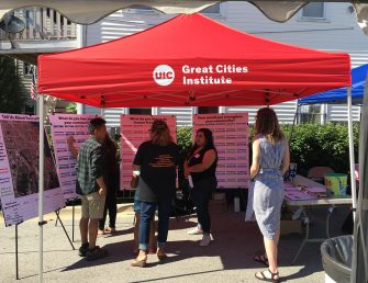
The UIC research team gathered input from community-based stakeholders through formal interviews, focus groups and informal pop-up engagement events to define the content of the report, inform their research and data collection, and prioritize goals for the area’s future plans.
The process revealed that residents and community leaders are interested in addressing public health and environmental issues; receiving municipal resources and support that are equitable to the city’s investment in North Side neighborhoods; and forming economic development policies that take advantage of the area’s Calumet River location and create jobs to make the community competitive in today’s economy.
To address these key issue areas, the report features the following considerations and recommendations for future planning in the Calumet River region:
Public Health and the Environment
- Prioritize remediation of contaminated industrial sites
- Strengthen regulations that require industrial contaminators to reduce pollution and remediate contamination at their own expense
- Create a Department of Environment at the city level to enforce remediation regulations, identify offenders and escalate the consequences of remediation noncompliance as needed
- Collaborate with the Chicago Department of Public Health to ensure that contamination is properly identified and that its health impacts are mitigated
- Increase access to public health resources within the community
- Advocate for more environmental and health programming at schools and throughout the community
- Build the organizational capacity for environmentally focused organizations
Social Equity
- Ensure that jobs created by remediation efforts and that the reuse of industrial sites are first offered to local businesses and residents of surrounding communities
- Increase housing availability for residents of all ages and income levels
- Improve public transit accessibility
- Increase community access to fresh fruits and vegetables
- Enhance bicycle and pedestrian paths
- Improve the park system
Economic Development
- Apply green technologies for remediation and economic development
- Establish and attract environmentally conscious businesses to the Calumet Industrial Corridor
- Continue to develop Commercial Avenue as the “Downtown of the Southeast Side”
- Expand commercial planning to other major corridors
- Continue to develop and capture new markets and visitors to the region
While the report focuses on three community areas in the Calumet River corridor, many of the issues and community perspectives are applicable to nearby areas, such as Hegewisch, Riverdale and Calumet Heights, for which the researchers provide demographic data.
“Collaboration among these three communities and others in the area could help prepare for future planning efforts within the area, including the industrial corridor modernization initiative planning process for the Calumet River industrial corridor, as well as ongoing efforts to improve the Illinois International Port District, which includes properties at the mouth of the Calumet River and at Lake Calumet to the west of the communities,” the researchers indicate.
The Great Cities Institute’s new report, produced via its Great Cities, Great Rivers Initiative, is the latest product of its ongoing work in the Calumet Region. In 2015, the institute led a planning process for revitalization of the Commercial Avenue corridor in the South Chicago community.
Working with the South Chicago Chamber of Commerce, Special Service Area 5, and other local groups, the institute steered a year of activities that solicited public input from residents, business owners, community organizations, service providers, and elected officials. The effort produced a plan, released in July 2016, which outlined the communities’ desire to revitalize their commercial corridors and address the decline that began with the closure of many industries along the river and Lake Michigan.
Great Cities Institute authors of the latest report are Teresa Córdova, director; project managers Jackson Morsey, urban planner, and Jack Rocha, community development planner; Tim Imeokparia, associate director of research and planning; Thea Crum, associate director of neighborhoods initiative; Benjamin Corpuz, research assistant; Elisabeth Rask, research assistant; and Alexis Stein, research assistant.
Calumet River Communities Planning Framework – South Chicago, East Side, and South Deering: A Guide for Equitable Development was partially funded by the Chicago Community Trust’s Our Great Rivers grant program.


