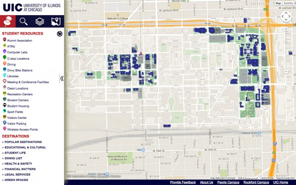
Find directions, resources with interactive campus map
The new interactive campus map is more than just an online version of a paper map.
Students and employees can use the map to locate campus buildings and search for nearby resources such as ATMs, Divvy bike stations and emergency phones. By clicking on a map location, users can find links to websites with more information on their destination.
“It’s loaded with a lot of resources,” said Patricia Pac-Dempsey, records management officer in the Office of Facility and Space Planning. “Everything is available here with just a click.”
The map is divided into categories: student resources, popular destinations, educational and cultural programs, dining, health and safety, and more. The site lets users view shuttle routes and find directions to, from and around campus.
The site was built last year by management information systems graduate students Maneesh Kodali, who continues to work on the project, and Aditya Trikutam, who graduated in May. Pac-Dempsey created the graphics. “It would not have been possible without the help of these incredibly talented students,” Pac-Dempsey said. “It really shows off our students’ skills and education.”
Version 2.0 is in the works, including an accessible map in text-only format and maps optimized for mobile devices and tablets. Future plans call for integrating the UIC shuttle tracking service and CTA bus and train trackers. “We want it to be a one-stop trip-planning system,” Pac-Dempsey said.
The Office of Facility and Space Planning collaborated on the project with the Academic Computing and Communications Center, the Office of Public and Government Affairs, Campus Auxiliary Services, the Office of Sustainability and the department of disability and human development.

